


In my first article on Bentley’s Year in Infrastructure (YII) 2022 event that was published last month, I provided an overview of the main technology updates shared by Bentley Systems. A key feature of this annual event are the customer presentations of infrastructure projects around the world that are deploying Bentley’s solutions in different ways. Collectively, they provide a concise snapshot every year of the strides that are being made world-wide in technology implementation in infrastructure.
This article provides an overview of some of the projects that were presented at the YII 2022 event.
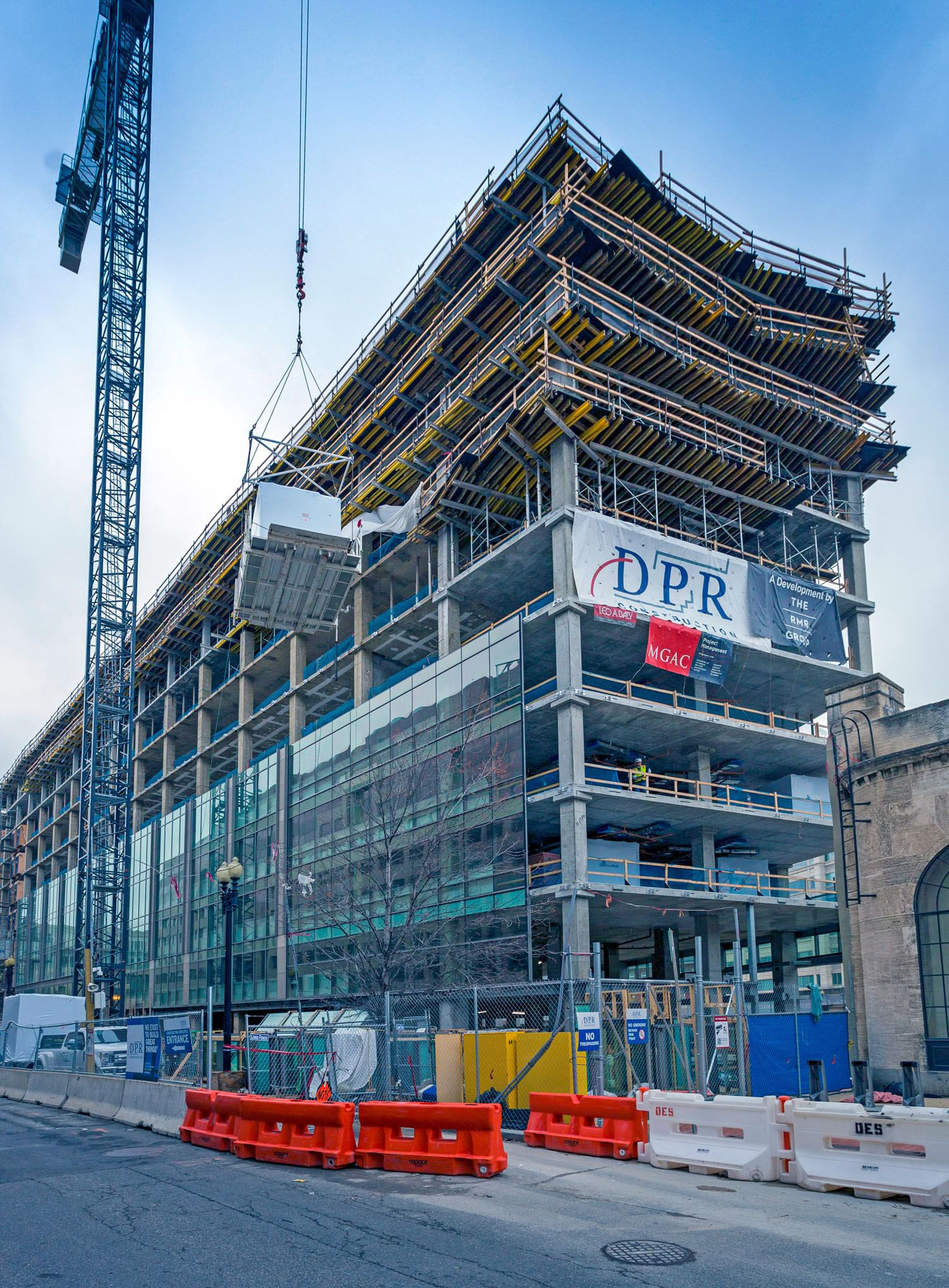
DPR Construction is one of the leading construction firms in the US, and it is well known for the advanced use of technology in its work. While it uses technology solutions from multiple vendors, one of the Bentley solutions it makes extensive use of is SYNCHRO for construction scheduling. At the YII 2022 event, it demonstrated how it was using SYNCHRO in its 20 Mass Ave project in Washington, DC (Figure 1), which was notable not just for the time and cost savings that came from the effective use of construction scheduling but also from the use of prefabrication on the project. Construction on it was started in April 2022 and is expected to be completed in April 2023.

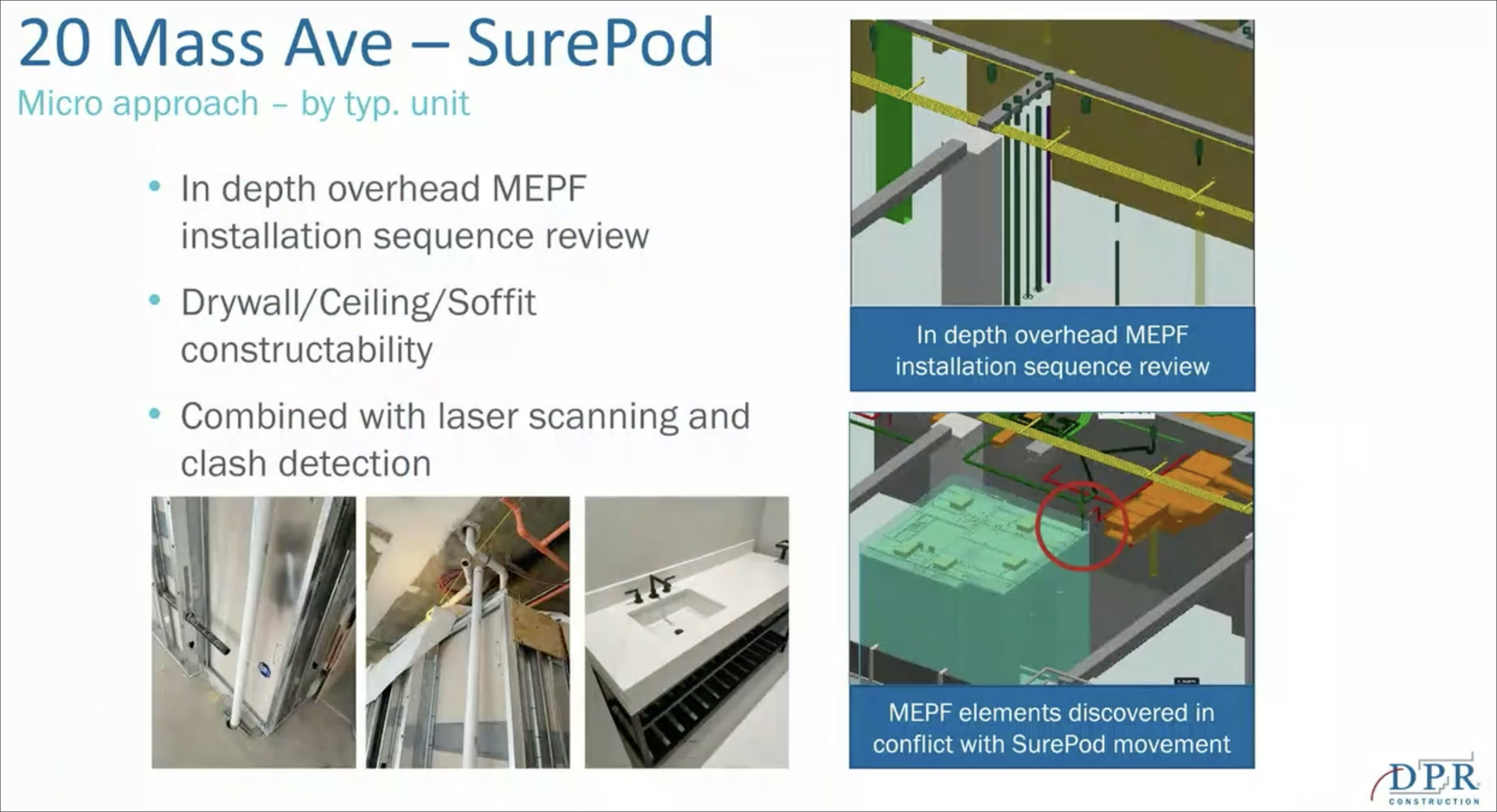
The 20 Mass Ave project involved remodeling an existing 8-story office building into a mixed-used office, hotel, and retail development. In addition to extending the building vertically by three floors as well as its horizontal footprint, the remodel included a new curtainwall and panelized façade, the addition of an atrium, structural enhancements, and a new roof. For the construction of the hotel rooms, the DPR team used over 200 modular fully-built bathroom pods (Figure 2), which were manufactured offsite at the same time as the construction proceed onsite, helping to shorten the project schedule considerably.

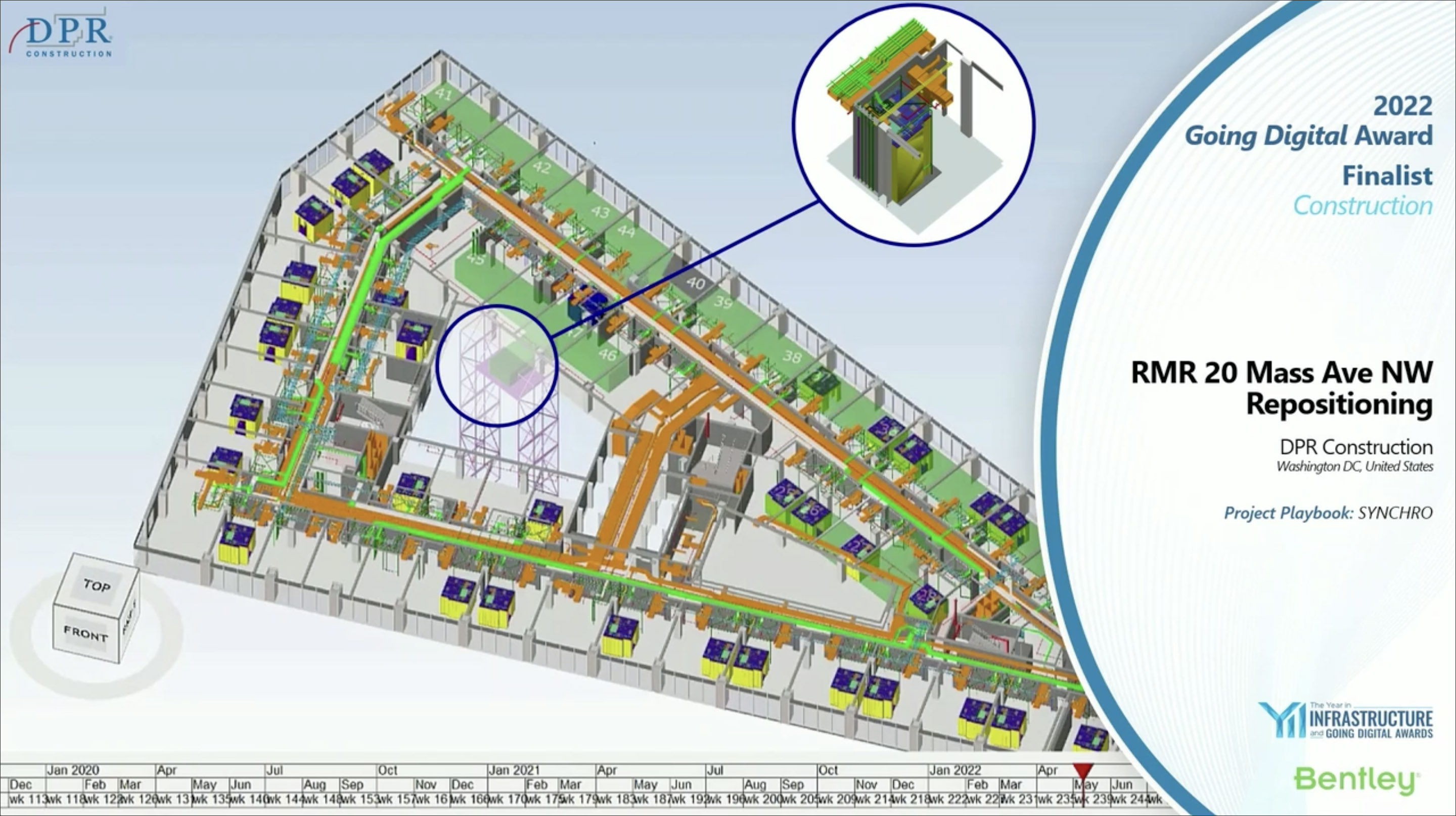
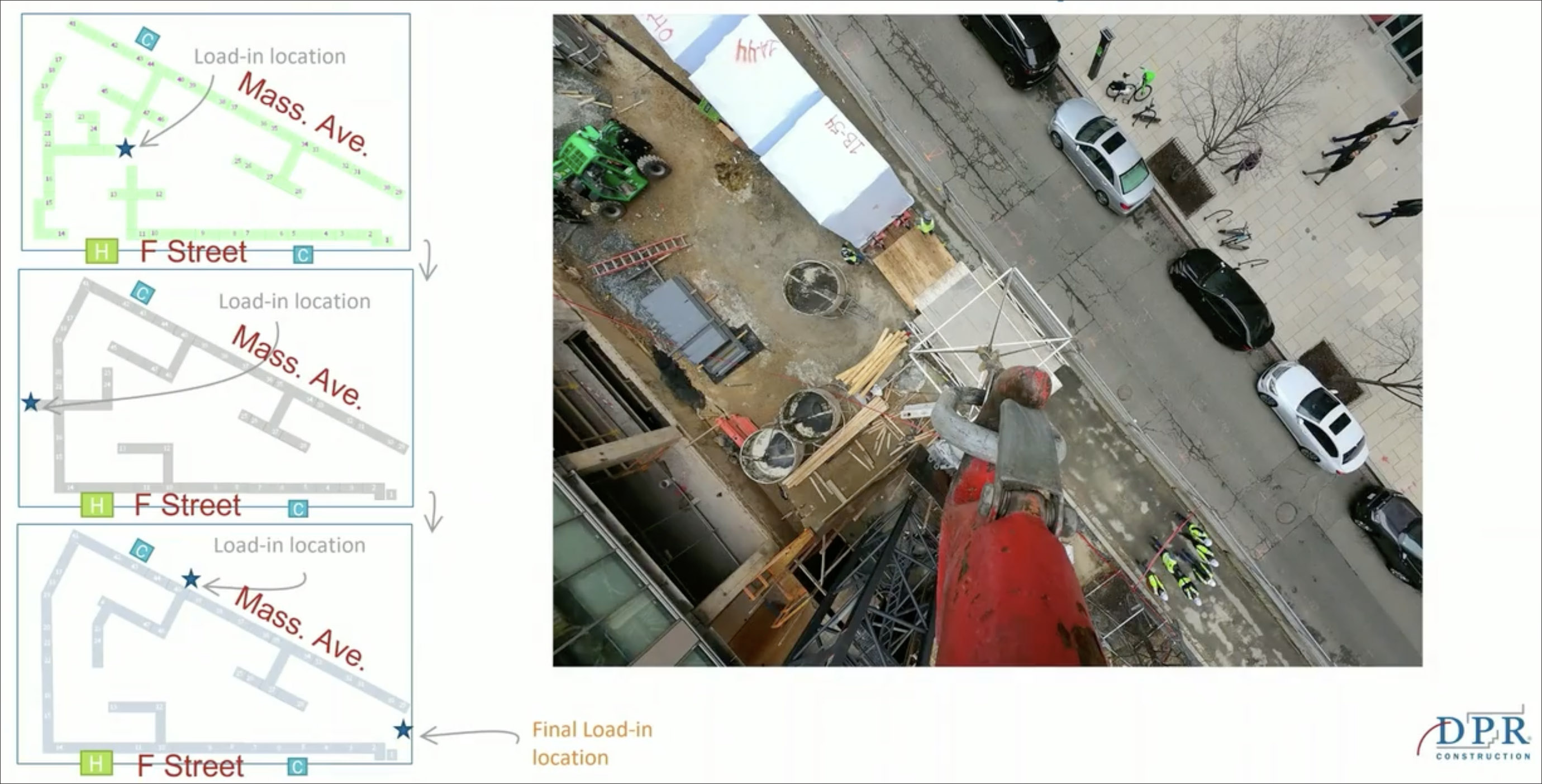
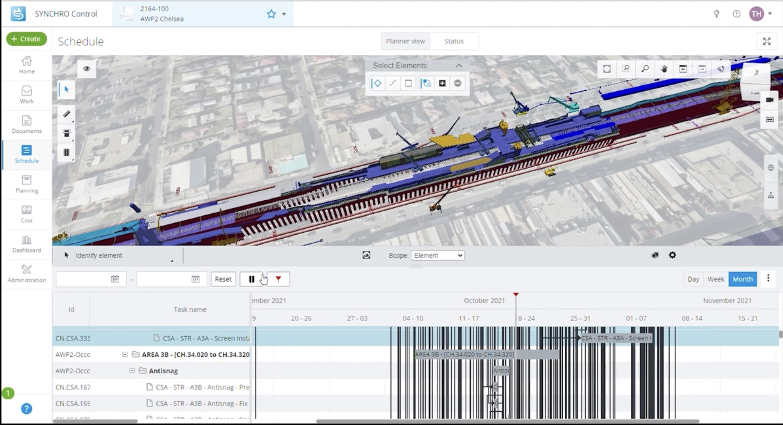
SYNCHRO was used to link the construction schedule to the 3D model of the project, enabling the construction team to visualize and communicate the plan for how the project would be built (Figure 3). In particular, the use of SYNCHRO helped to ensure that the prefabricated units could be delivered and installed without any obstacles, risks to site personnel, or any other logistical issues, while at the same time, aligning to the overall construction schedule of the project. It also helped to determine which was the best location for the placement of the crane that would be hauling these pods up to the individual floors for installation, as well as plan the sequence of events in the individual installations once they were in place (Figure 4).
Overall, not only did the use of prefabrication shorten the construction schedule for the project in and of itself, the time savings that were achieved were even more significant when paired with the use of SYNCHRO for the planning.
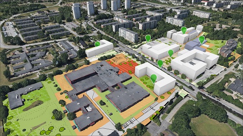
Foth is a leading US-based engineering and environmental firm, with offices in 28 locations across the country, that has been providing infrastructure services to communities for over 80 years. It was commissioned by Perry, a city in Iowa, to evaluate street and sidewalk conditions using mobile LiDAR scanning to evaluate their level of ADA (Americans with Disabilities Act) compliance and improve pedestrian access for its citizens. While this was the starting point of the project, the potential of the technology to do much more was soon realized by city administrators, and they expanded the scope of the project to create a full city-wide scan (Figure 5) that could be used in many ways: it would help to support the city’s capital improvement program; make it easier to apply for state and federal grants to modernize its infrastructure; and improve its asset management, disaster preparation and recovery, and historic preservation initiatives.
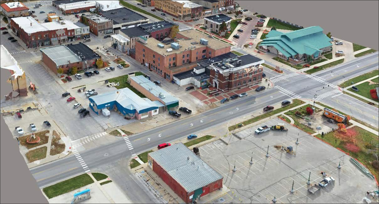
The project involved digitizing over 70 miles of streets and alleyways, combining the street level laser scans, aerial images, and geospatial data into a city model — a virtual representation of Perry — that contained USD 598 million worth of asset data. Foth used Bentley solutions including MicroStation, OpenRoads, ContextCapture, and ProjectWise to process and integrate all of these large and diverse datasets into the city model and make it easily accessible to the city staff. In particular, the integration between MicroStation and TopoDOT — a point cloud processing solution for the transportation industry — was a huge benefit, as the project also involved the intensive implementation of TopoDOT for extraction workflows and simultaneous collaboration (Figure 6).

Looking ahead, the goal is to create a digital twin of the city which can facilitate further “smart city” operational efficiency and improve the quality of life for its residents. While this would require installing IoT sensors in strategic locations throughout the city and connecting them to the digital model so that it can capture real-time operational data about the city, even the static “city information model” that has been created so far is ground-breaking — Perry is the first city in Iowa, and one of only a handful of cities across the American Midwest, to have embarked on such an initiative. (For more on functioning digital twins and city information models, see the articles , SmartBRIDGE Hamburg: A Digital Twin in Action and City Information Modeling respectively.)
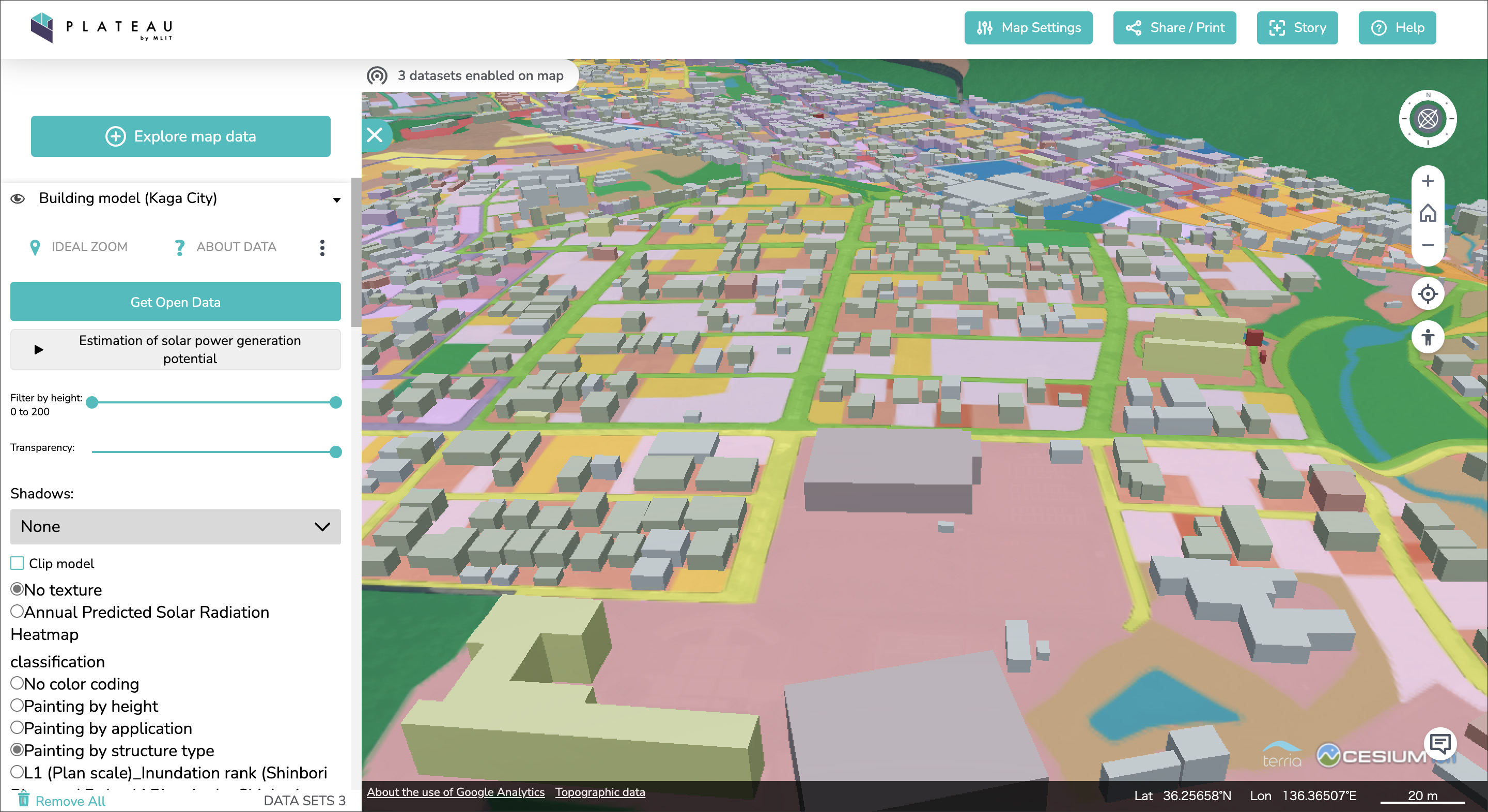
Another initiative in 3D city modeling was presented by the firm, Kokusai Kogyo, which is one of the participants in Project PLATEAU, an ambitious program by Japan to develop open 3D models of its cities that can be used for smart-city planning and management. The project is being overseen by Japan’s Ministry of Land, Infrastructure, Transport and Tourism. It was launched in 2020 with the initial goal of developing 3D city models of 56 cities nationwide. The models, which comprise of multiple datasets for each city, can be viewed in a web-based platform that was specifically developed to be open and accessible (Figure 7). The future roadmap for the project involves creating city models for approximately 500 cities nationwide by 2027, increasing their level of detail, and promoting utilization by developing advanced use cases to demonstrate how to use their data.
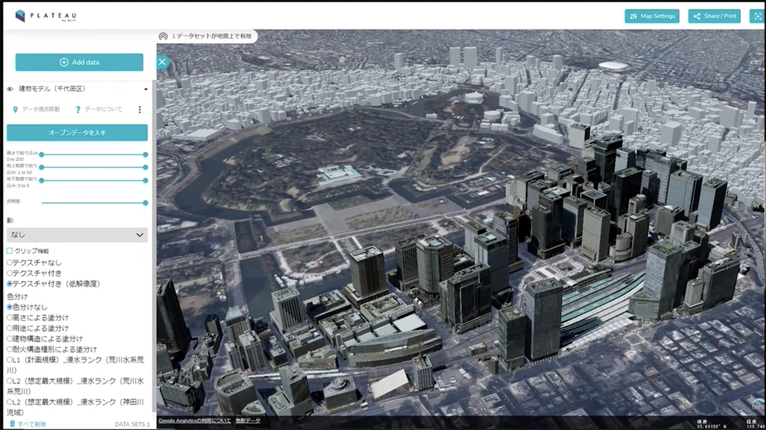
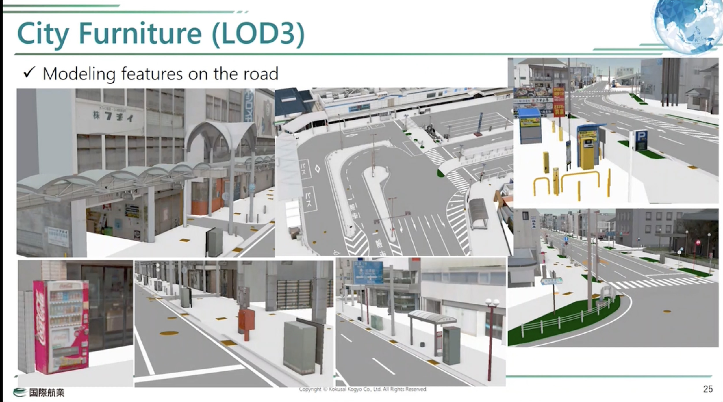
Needless to say, a nation-wide initiative like this includes many project partners for implementation, one of which is Kokusai Kogyo, a leading Japanese firm that works in multiple fields including geospatial information and urban development, among others. Kokusai Kogyo is tasked with creating the models of 17 cities for Project PLATEAU, and one of the examples it shared at the YII 2022 event was the work it was doing in Numazu City. The use case for this 3D city model was to enable automatic driving of an electric bus using VPS (Vehicle Positioning System). Kokusai Kogyo was able to achieve the high level of detail this required by using MicroStation to model the building geometry of the individual structures from the point cloud data captured with LiDAR scans (Figure 8).

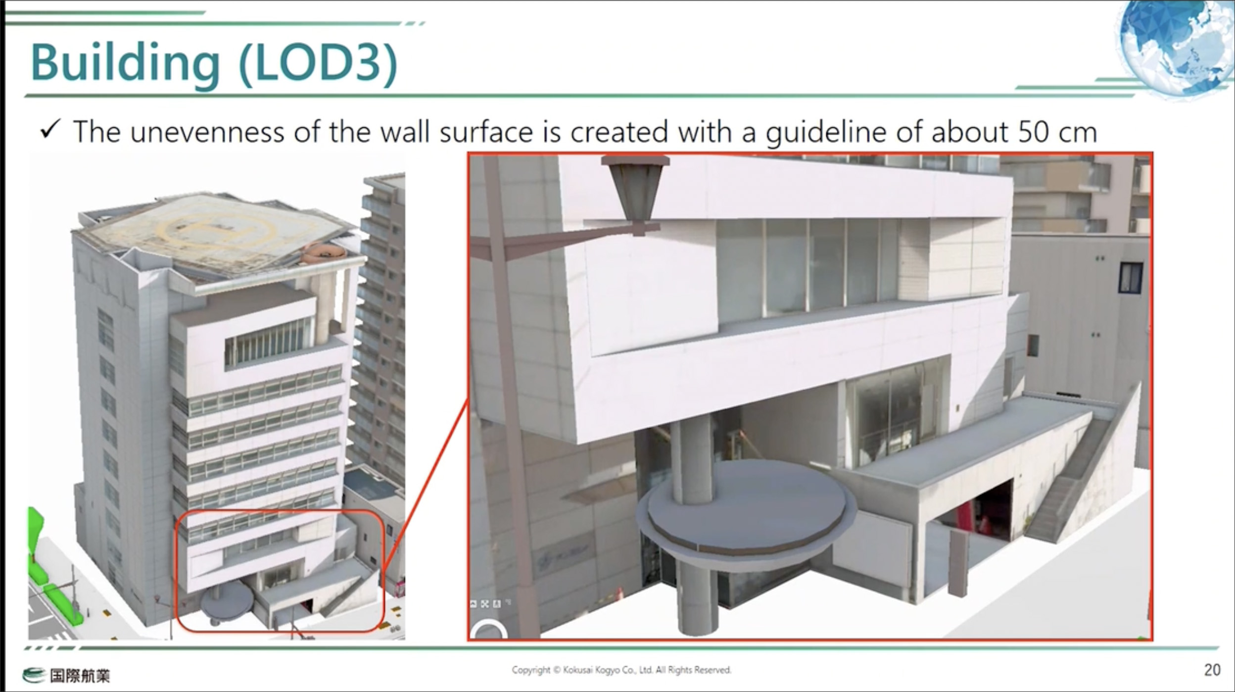
While most of the other city models in Project PLATEAU so far are to the LOD2 level of detail, the model of Numazu City created by Kokusai Kogyo goes up to LOD3, thanks to its use of MicroStation for the detailed modeling of complex features in buildings such as façades, podiums, stairs, and so on (Figure 9), as well as other elements of the city including roads, sidewalks, traffic lights, fences, vegetation, etc. (Figure 10).
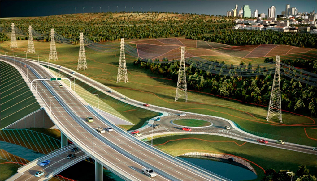
ACCIONA is a multinational conglomerate that works on infrastructure, transportation, water, and renewable energy projects in over 30 countries around the world. The project it presented at YII 2022 was part of a contract awarded to an alliance of ACCIONA and four other firms by the government in Victoria, Australia, to remove 20 of the most dangerous level crossings along the Frankston Line in Melbourne and construct 3 new stations (Figure 11).
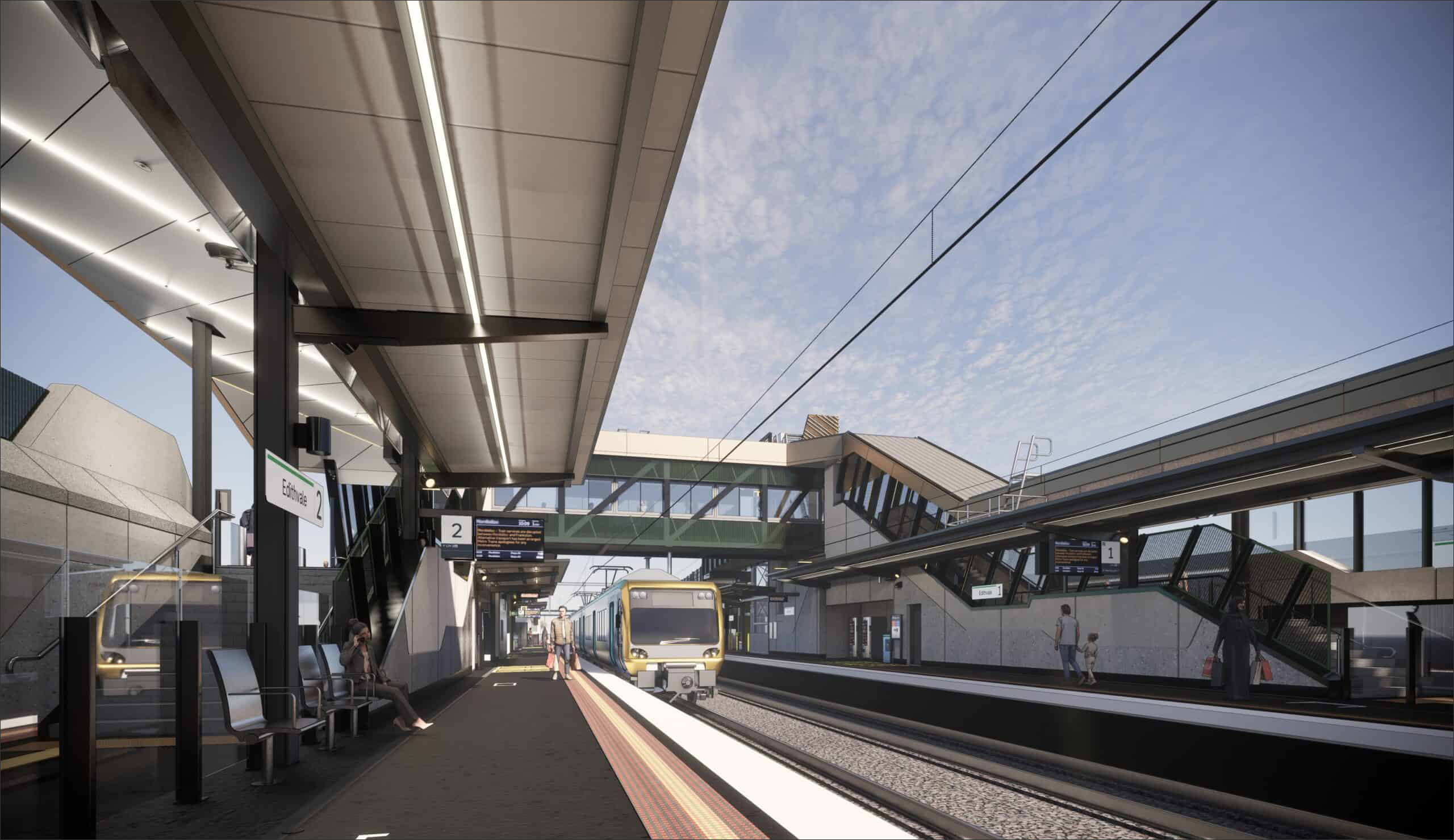
Level crossings were common in the early days when railway networks were first being built, when the trains were slower and fewer and there were less cars on the roads. Railways are built today without any level crossings, and there are initiatives in many countries to eliminate as many of them as possible (see this article about removing level crossings at Network Rail in the UK). In the case of the Melbourne project, the vision was to eliminate the most dangerous and congested level crossings, making travel easier and safer.
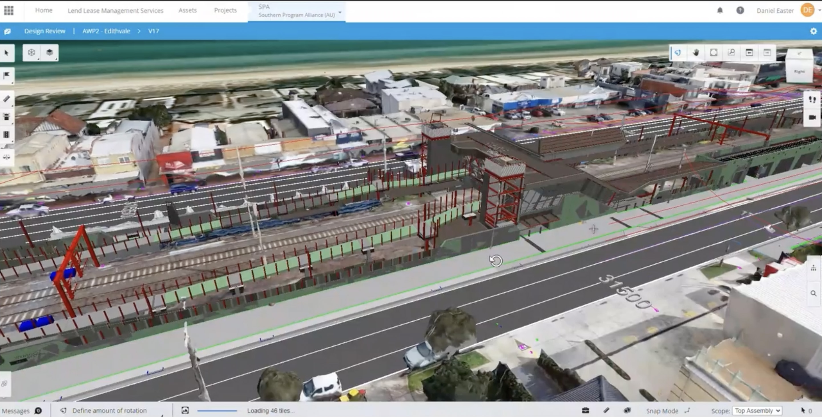
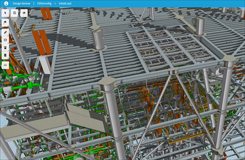
In its role as Contractor in the alliance, ACCIONA deployed several Bentley tools including ContextCapture, iTwin.js, LumenRT, MicroStation, OpenBridge, OpenRail, OpenRoads, ProjectWise, and SYNCHRO to digitally construct the project effectively and efficiently as well as deliver it on time, despite being required to work in congested areas and coordinate the construction planning among a large stakeholder group. ProjectWise was adopted as the CDE (Common Data Environment) for the project, and iTwin Services was deployed with iModel Design Review enabling 3D model cloud collaboration (Figure 12). Having an automated link between the CDE and the federation environment — there were close to 60 federated model updates every week — reduced the team’s model management effort substantially. Reality data captured with drones was integrated into the project using ContextCapture, providing clarity on site constraints and adjacent developments (Figure 13).
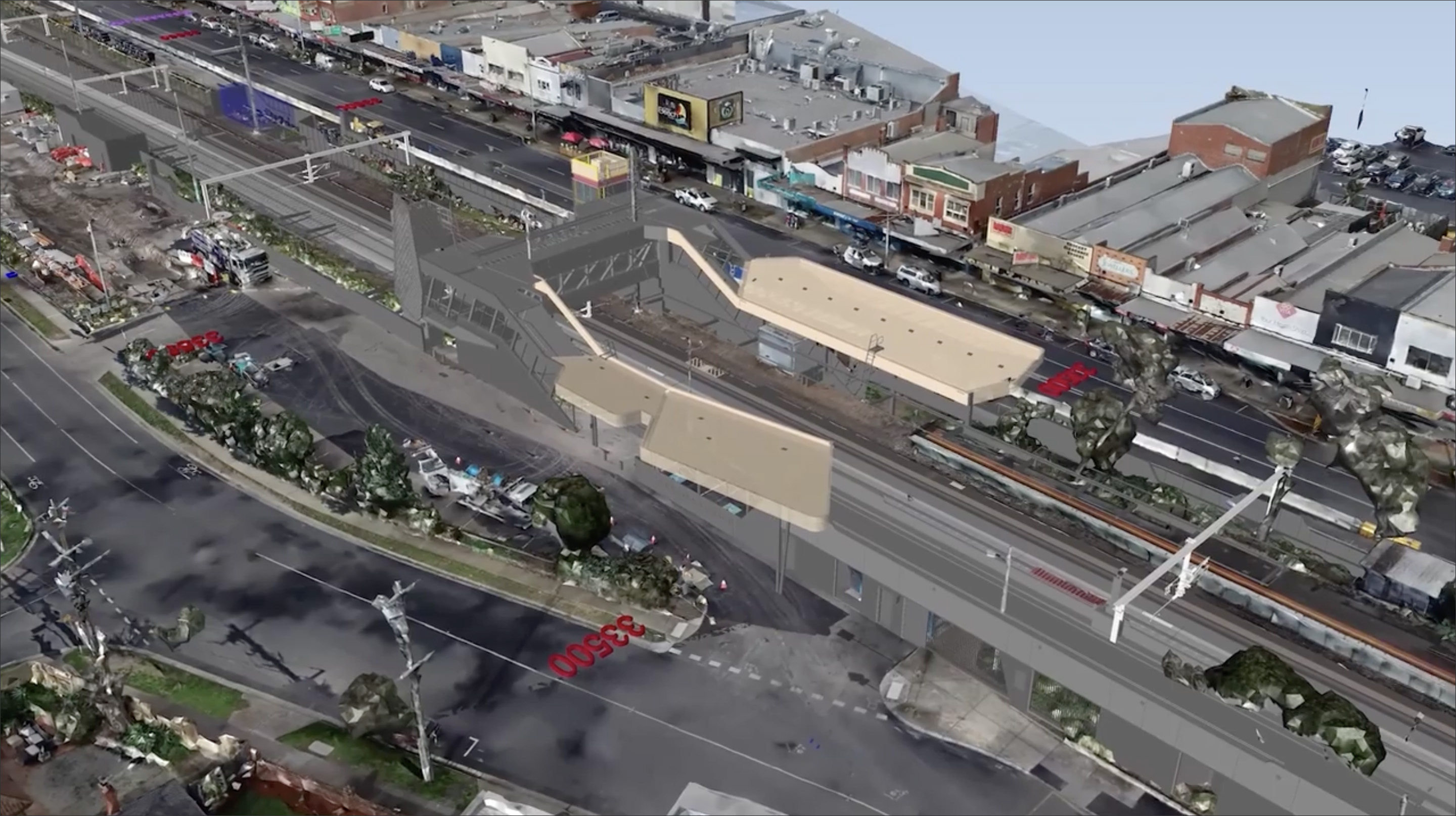
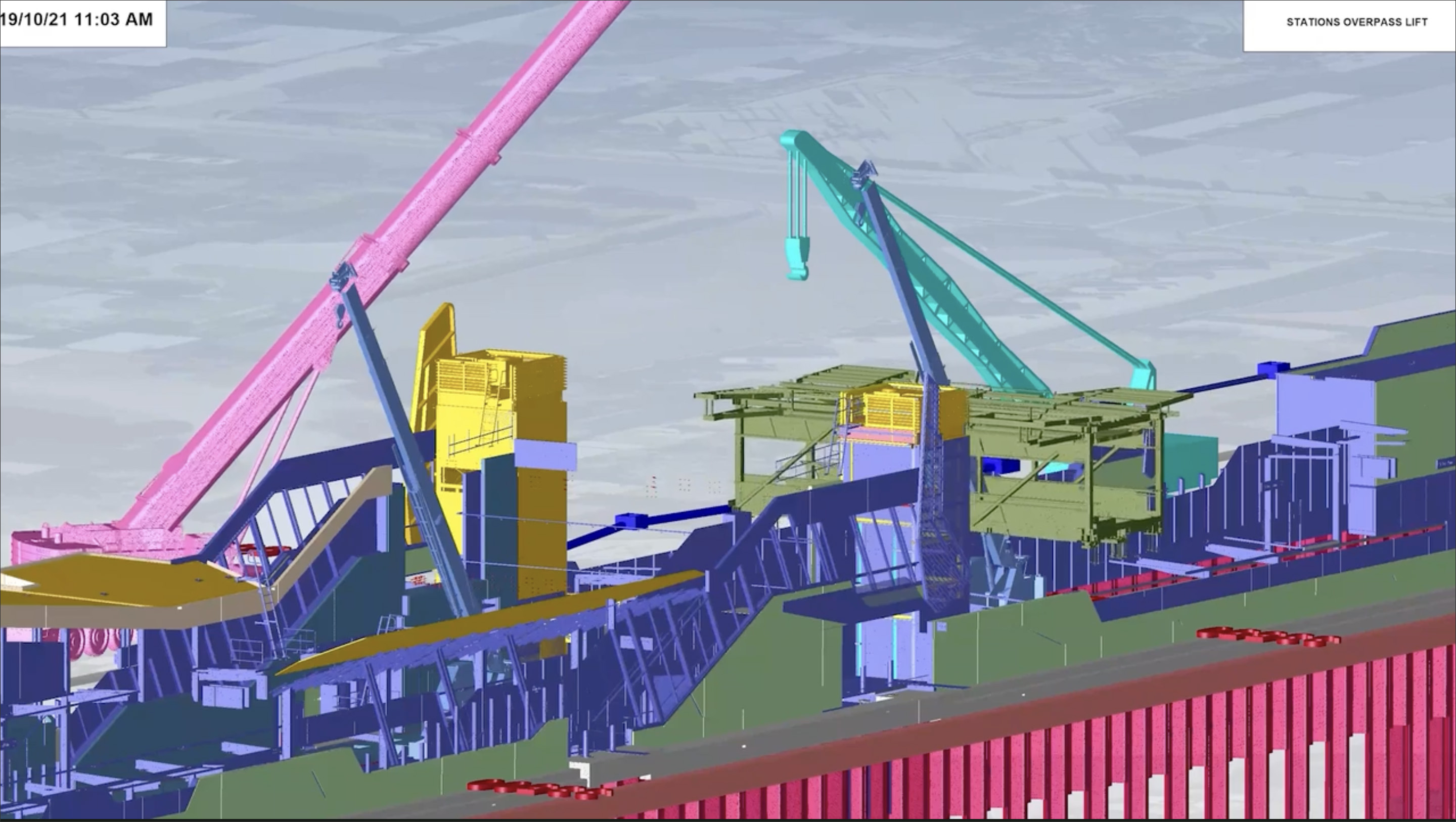
The project data stored in the CDE was also used for project scheduling using SYNCHRO and its integration with Primavera P6, allowing the construction activities on site to be visualized and optimized (Figure 14). Especially critical were the lift sequences for the overpass at the stations, which were taken through numerous digital dress rehearsals so that they could be erected on site safely without any issues. (Figure 15). SYNCHRO was also the platform that was deployed on site to manage the construction and communicate the site activities to the construction personnel as they were being adjusted in real time through the P6 application. The project team even developed a custom script to enhance the personnel’s understanding of the site activities as they were updated daily.
The projects covered here are only a fraction of those presented at Bentley’s Year in Infrastructure 2022 event. The full listing of projects, across all of the many infrastructure categories that are served by Bentley’s solutions, is available at: https://www.bentley.com/events/going-digital-awards/finalists/
I found them all so interesting and really appreciated the “tour of the world” so to say, learning about the kinds of projects being built in different countries all over the globe for people to live in and use every day, as well as the cutting-edge technology implementations by the AEC firms who are working to build them.
Lachmi Khemlani is founder and editor of AECbytes. She has a Ph.D. in Architecture from UC Berkeley, specializing in intelligent building modeling, and consults and writes on AEC technology.
Have comments or feedback on this article? Visit its AECbytes blog posting to share them with other readers or see what others have to say.
AECbytes content should not be reproduced on any other website, blog, print publication, or newsletter without permission.
The key technology updates shared by Bentley include extension of its iTwin platform, the ability to visualize its digital twins in gaming engines, a new Bentley Infrastructure Cloud offering, expansion of SYNCHRO to include 5D, EC3 integration, and more.
The AEC industry has gone from manual drafting to CAD, then from CAD to BIM, and now from BIM to digital twins. This paper explores the technology of digital twins and its potential in the AEC industry to go much further than BIM in terms of impact and benefits.
This article is focused on capturing the developments in the software available for BIM for infrastructure, including solutions from Site3D, CGS Labs and SierraSoft, Allplan Civil Engineering and Allplan Bridge, Autodesk Civil 3D and InfraWorks, and the many solutions from Bentley.
Exploring the solutions for “city information modeling” from BIM stalwarts such as Autodesk and Bentley to CIM-specific companies such as virtualcitySYSTEMS, Cityzenith, SmarterBetterCities, CyberCity 3D, and Agency9. Also, how is CIM different from the concept of “Smart Cities?”.