


Earlier this month, I attended a SmartCitiesWorld webinar which explored how Dublin City Council, which governs the city of Dublin in Ireland, is leveraging digital twin technology to enhance city management and operational efficiency. The webinar was held in association with Bentley Systems, which is the main technology vendor that Dublin City Council is working with for this work.
The application of digital twin technology to cities has continued to gain momentum in conjunction with the smart cities movement, which I first wrote about in 2016 in the article, “City Information Modeling .” Subsequent implementations that AECbytes covered include the DUET (Digital Urban European Twins) project , which was focused on creating digital twins of cities in Europe to allow them to be better designed, operated, and managed; the City of Cambridge , Massachusetts, which has created a citywide 3D model that can be used by residents, urban designers, architects, and city staff for visualization, design, analysis, and planning; and platforms for creating city-scale digital twins such as Bentley OpenCities CityPlanner , IES Intelligent Communities Lifecycle (ICL), and Sova3D .
It was fascinating to learn about the actual implementation of digital twin technology in a large city that is spearheaded by the city authorities themselves and who appear to fully understand the technology, including what it can and cannot do. In fact, Dublin City Council has a dedicated Digital Twin Ecosystem Manager, Dr Mani Dhingra, leading its digital twin work, and her presentation at the SmartCitiesWorld webinar provided a concise overview of Dublin’s digital twin implementation that I found extremely informative.
Dublin is the capital and largest city of Ireland and its main financial, commercial, and cultural hub. Located on the Dublin Bay in the east coast of the country bordering the Irish Sea, it is also the country's chief port. Its official name is "City of Dublin," which is used to refer to it in formal documents, and it is governed by the Dublin City Council. Its 2025 population is estimated to be about 1.3 million (see https://worldpopulationreview.com/cities/ireland/dublin), and it has been ranked among the top thirty cities in the world by the Globalization and World Cities Research Network.
The city’s Docklands area (Figure 1) hosts many of the world’s leading technology companies as well as technology start-ups, giving it the moniker “Silicon Docks” inspired by the Silicon Valley of the San Francisco Bay Area in the US.

Dublin’s digital twin journey started in 2016 with the launch of the Smart Dublin program (Figure 2). This is a broad initiative jointly established by four local Dublin authorities – one of which is the Dublin City Council -- to bring technology providers, researchers and citizens together to develop solutions that can transform public services and address urban challenges. The initiative is focused on several areas including tackling climate challenges and improving sustainability, improving communication between the citizens and the local government, improving mobility and reducing congestion, supporting economic progress and financial well-being, enabling the government to make better decisions and deliver better services, and strengthening community engagement and improving both the physical and mental health of its citizens.
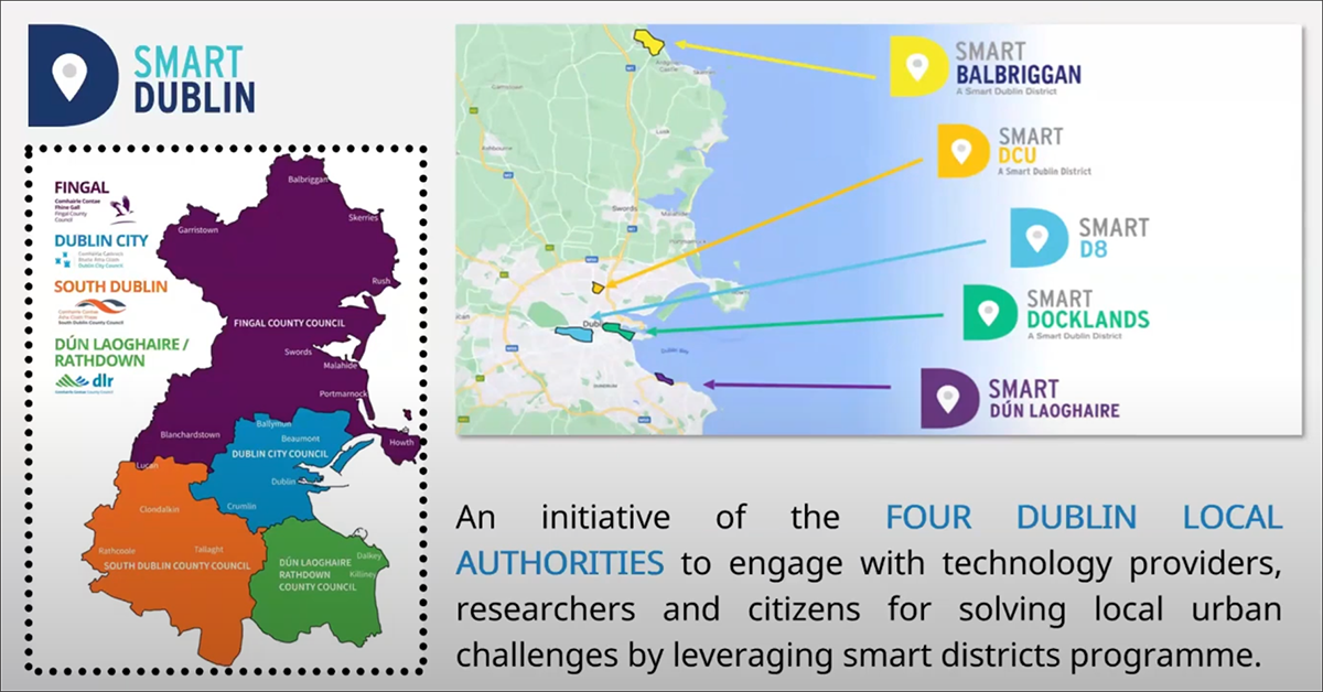
Some of the Smart Dublin projects include Smart Docklands, which has made the Docklands area that was shown in Figure 1 a smart city district; Smart DCU (Dublin City University), a smart campus environment for students and faculty where new technologies can be tried and tested; and Smart D8, which is one of the most recent testbed districts focused on health and well-being. More information on all these initiatives can be seen at https://smartdublin.ie/.
Efforts to further the technology implementation to make Dublin a smart city ramped up in the following years, with the development of digital twin technology and its ability to create a dynamic model of the city that can provide real-time status and performance monitoring. It involves maintaining a bidirectional integration between the city and its virtual representation with the help of sensors and IoT (see Digital Twins in AEC: AECbytes White Paper), so that the digital twin is always in sync with the city’s physical assets and can be used for real-time analysis and simulation.
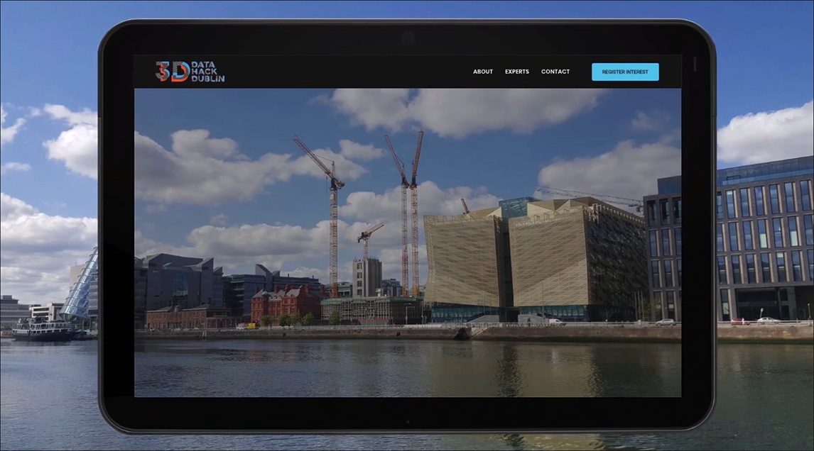
The starting point for creating a digital twin of any asset is a 3D model of it, and for Dublin, it started with a 3D model of the Docklands area which included all the existing buildings as well as the new buildings that were under construction (Figure 3). The model was open-sourced to a large community of planners, coders, and developers, forming the basis of a 3D Hackathon in 2019 to explore new ideas and insights on how this data might be used to improve city planning and management. Many of the later digital twin initiatives such as “Digital Twin for Emergency Management” for first responders and the fire department (that will be described in more detail later) came directly from the ideas and prototype applications developed at the Hackathon.

Subsequent digital twin technology implementation by the Dublin City Council has accelerated with several additional projects such as augmented reality (AR) for smart tourism which uses Google and Cesium photorealistic tiles, digital twins for resilient housing which works on modeling social housing stock for informed decision making around climate action, a joint project with 13 other countries from North-West Europe that is building four foundation frameworks for digital twins, and a project in partnership with Bloomberg Philanthropies for healthy cities that focuses on data insights for active travel (Figure 4).
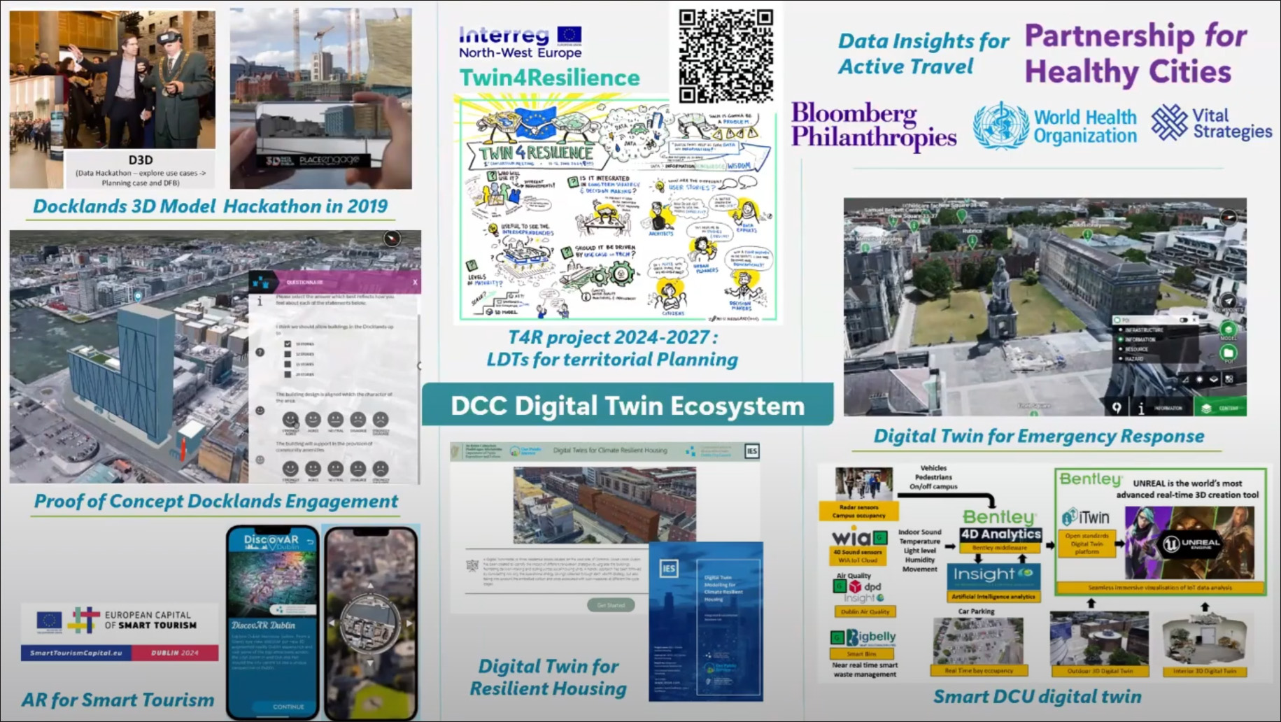
Three of the Smart Dublin digital twin projects were done in close partnership with Bentley Systems, and they were described in more detail at the SmartCitiesWorld webinar.
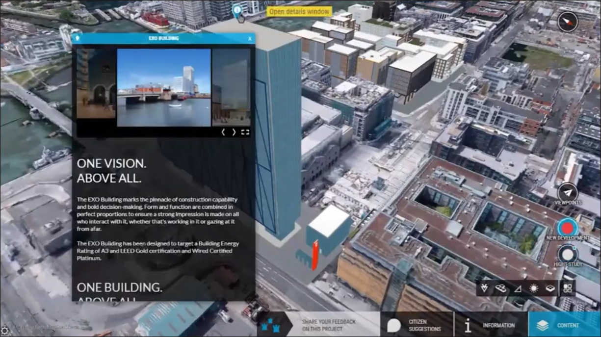
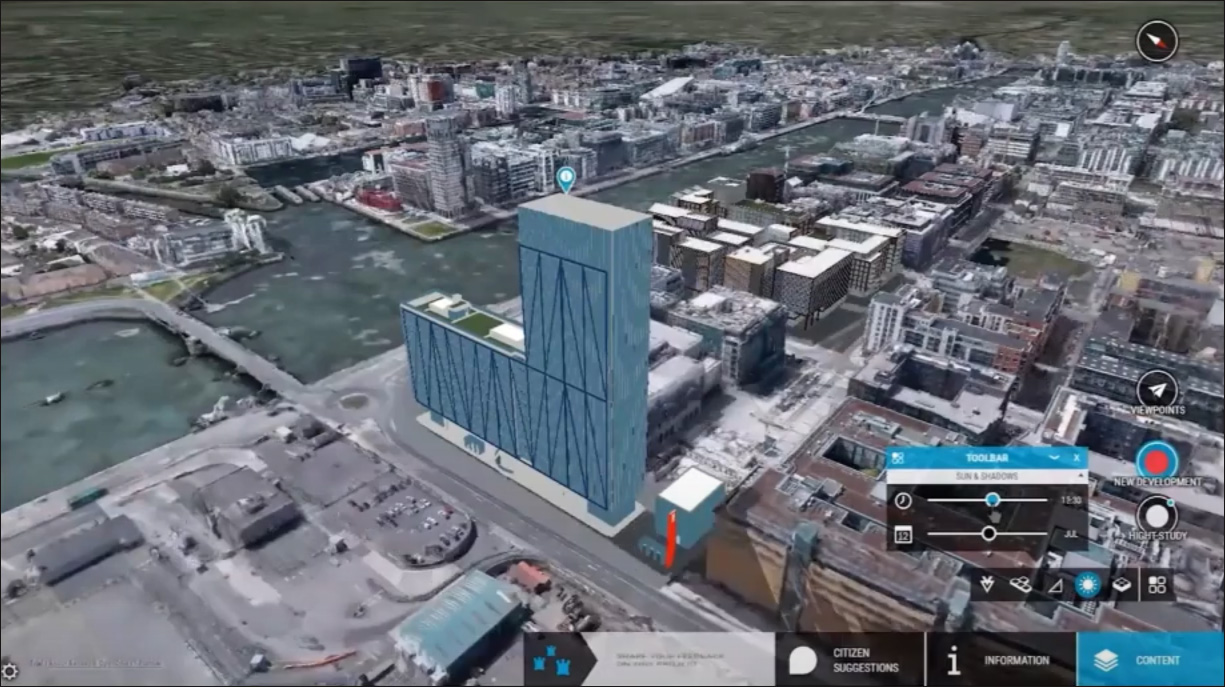
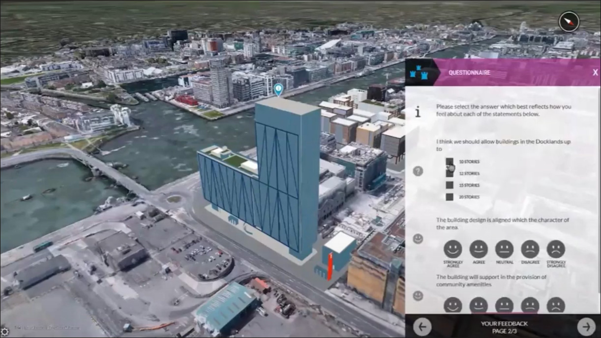
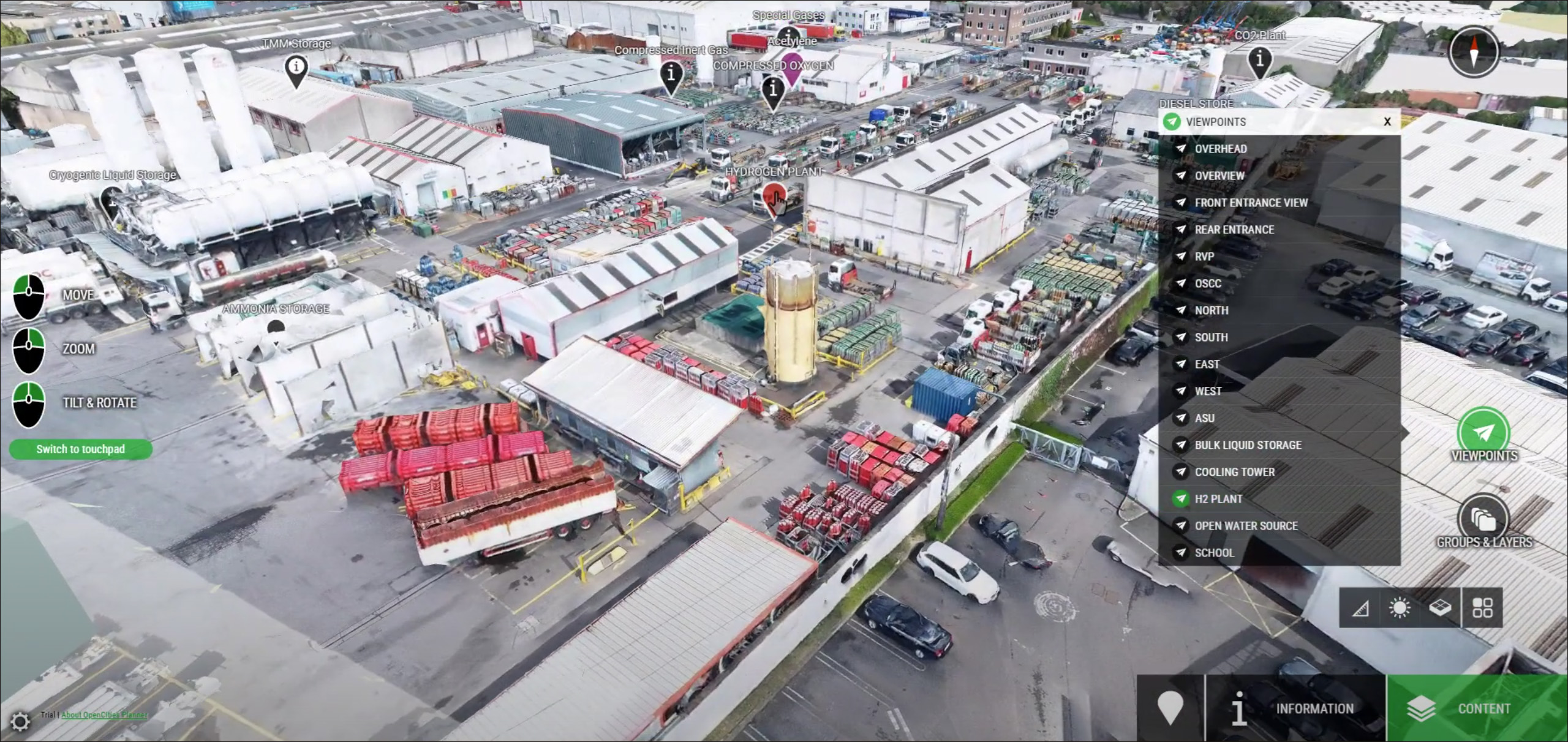
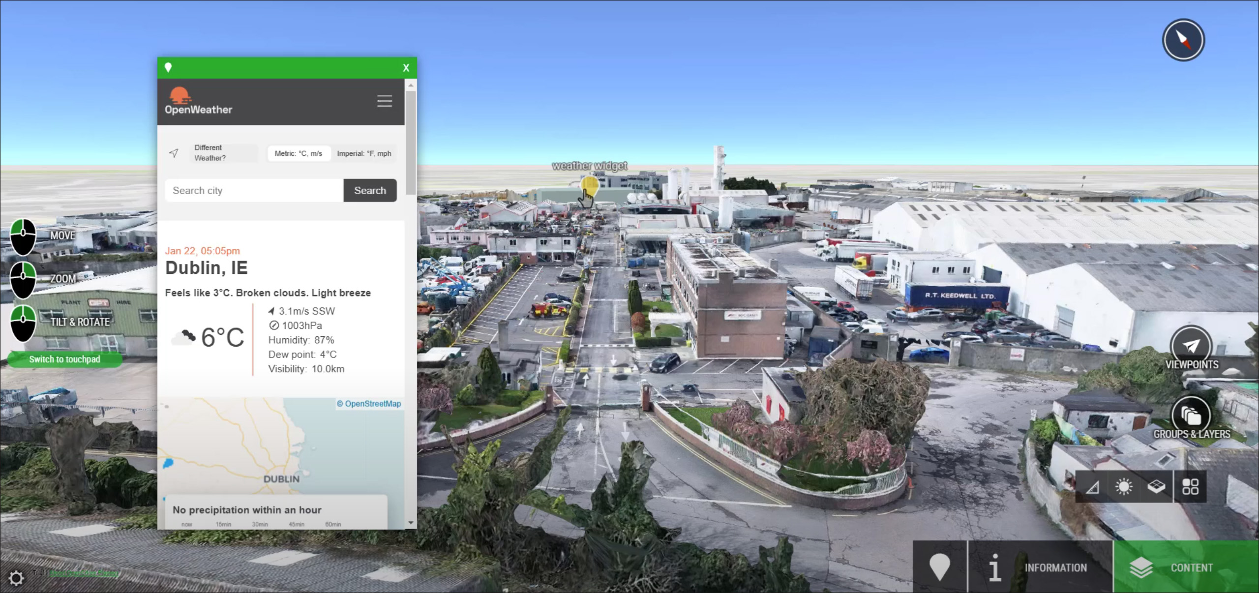
The Smart Docklands project is where the digital twin collaboration with Bentley began. It was a proof of concept implemented in the year 2020. The 3D model of the Docklands area that had been acquired by the Dublin City Council and used for the 3D Hackathon in 2019 — as shown earlier in Figure 3 – was brought into Bentley’s OpenCities Planner. This application allowed the model to be uploaded to the cloud for easy access and analysis. Using the tools in OpenCities Planner, you could fly though the model and get a realistic-looking snapshot of the city, see details of proposed developments and what they will look like, create different scenarios and show their impact with additional information and data provided in pop-up windows, create different start points for navigating through the model, carry out different analyses such as shading at different times of the day, and so on. An interface was also developed to enable citizens to provide feedback on different aspects of the city, allowing the city council to engage directly with the public, which was one of the key objectives of the project. Some of these functionalities are demonstrated in Figure 5.
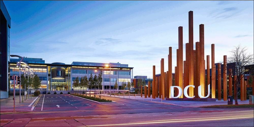
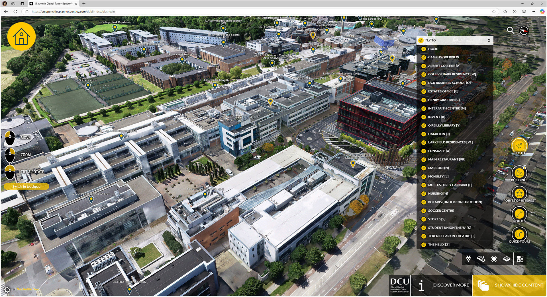
The next case study that was presented is Smart DCU, which used Bentley’s tools to build a digital twin of the DCU (Dublin City University) campus. It was a partnership between the university, the city council, and INSIGHT, which is Ireland’s national research center for data analytics. The project involved modeling both the exterior and the interior of the campus using drones and LIDAR scanners, which were consolidated and displayed in Bentley’s iTwin platform (Figure 6). The consolidated model was then linked to IoT data streams from the different types of physical sensors that have been installed all over the campus, including sound sensors, digital crowd counting, vehicle tracking, and environmental sensors. This allows real-time data analytics of aspects such as mobility, usage patterns, occupancy, and safety, allowing the campus environment to be dynamically explored in a web browser (see https://www.dcu.ie/CampusExplorer). Gaming technology is also being deployed to create immersive experiences, so that the spaces in buildings can be explored with VR headsets. This is especially helping in supporting DCU’s autism-friendly initiatives, allowing neurodivergent individuals to experience a space virtually before visiting it. Another feature currently in development is the ability to integrate 3D BIMs of individual buildings into the campus digital twin.
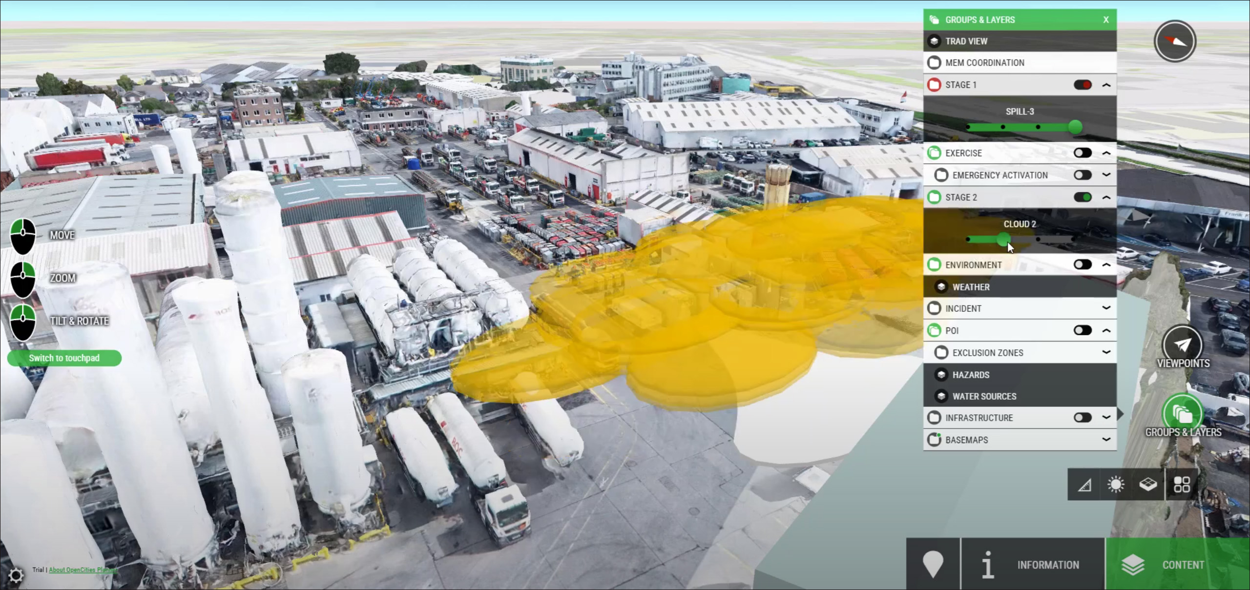
And finally, additional details were shared about the “Digital Twin for Emergency Management” project that was mentioned earlier. This project is being done with Dublin Fire Brigade with the aim of reducing pre-incident planning time for firefighting, allowing more effective preparation, faster response, and increased safety. What is key here is operational intelligence, so that the first responders can decide in real-time on the best routes to take to the location of the emergency. Bentley’s iTwin technology was used to create the digital twin integrating multiple data sources including spatial data, IoT sensors, location of critical infrastructure such as fire hydrants and utility lines, and additional dynamic data feeds from other sources. By capturing and organizing all the relevant data, the digital twin allows incident commanders to access critical information quickly, improving situational awareness and decision making (Figure 7). Some of the ongoing work on this project includes creating hypothetical scenarios – such as increased fire risk based on specific weather conditions and wind direction and strength – to determine the possible impact and pre-plan the emergency response before it occurs.
It was heartening to see the wholehearted embrace and in depth application of digital twin technology on a city-wide scale to one of the world’s top-tier cities. Dublin aims to be a truly digital city by 2030, one that is dynamic, sustainable, and future-ready (see this Dublin City Council report), and to do so, it is taking “digital twins” from being an abstract concept (albeit a much-hyped one) to a foundational reality that can provide the platform on which actual, working, high-impact projects like the ones described in this article can be built.
I hope learning about Dublin’s digital twin implementation provides an incentive to other cities to emulate Dublin’s forward-thinking approach to city planning and management, which can help to make the lives of their citizens much easier and safer, and a lot more enjoyable.
Lachmi Khemlani is founder and editor of AECbytes. She has a Ph.D. in Architecture from UC Berkeley, specializing in intelligent building modeling, and consults and writes on AEC technology.
Have comments or feedback on this article? Visit its AECbytes blog posting to share them with other readers or see what others have to say.
AECbytes content should not be reproduced on any other website, blog, print publication, or newsletter without permission.