LandDesign was founded in 1978 in Charlotte, North Carolina, with a mission to create places that bring people together. Now headquartered in Charlotte and with offices in five additional major U.S. markets, the firm is staffed by a collaborative group of landscape architects, civil engineers, planners, and urban designers, who approach projects with unique expertise and diverse perspectives. All of us share a goal of creating places that matter – places people love, and where people work, live and play.
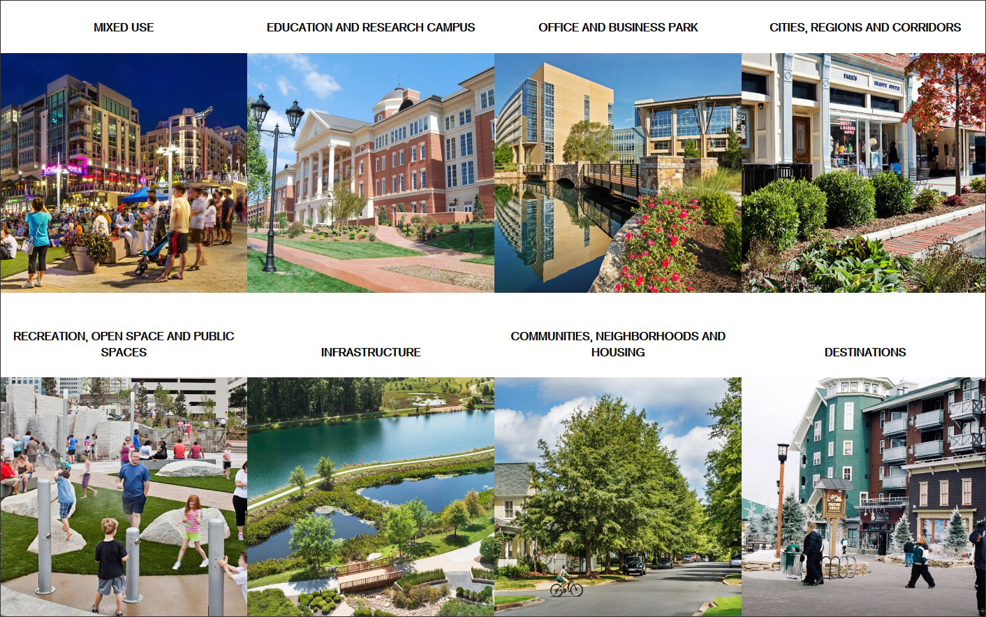
Currently we are focused on mixed-use development, master planned communities, institutional and corporate campuses, and projects of varied kinds that are creating or reimagining public spaces (Figure 1). We envision public spaces as something that a community can enjoy and take pride in. Current projects for LandDesign include Offices at the Realm, a Dallas, Texas-area mixed-use development planned and conceived with an expansive park and outdoor entertainment spaces adjacent to 235,000 square feet of Class AA offices, plus dining and retail. We are also at work on a number of new transit-oriented development (TOD) sites that will transform the experience in Tysons, Virginia.
LandDesign has a long history of exploring and adopting digital tools and technology, often at early stages in development. Historically, our firm culture is based in a belief that sketches matter. No matter the project, the first thing our designers produce is always drawn by hand. We still push this notion, even with our more tech-savvy new hires, and our clients appreciate the balanced approach.
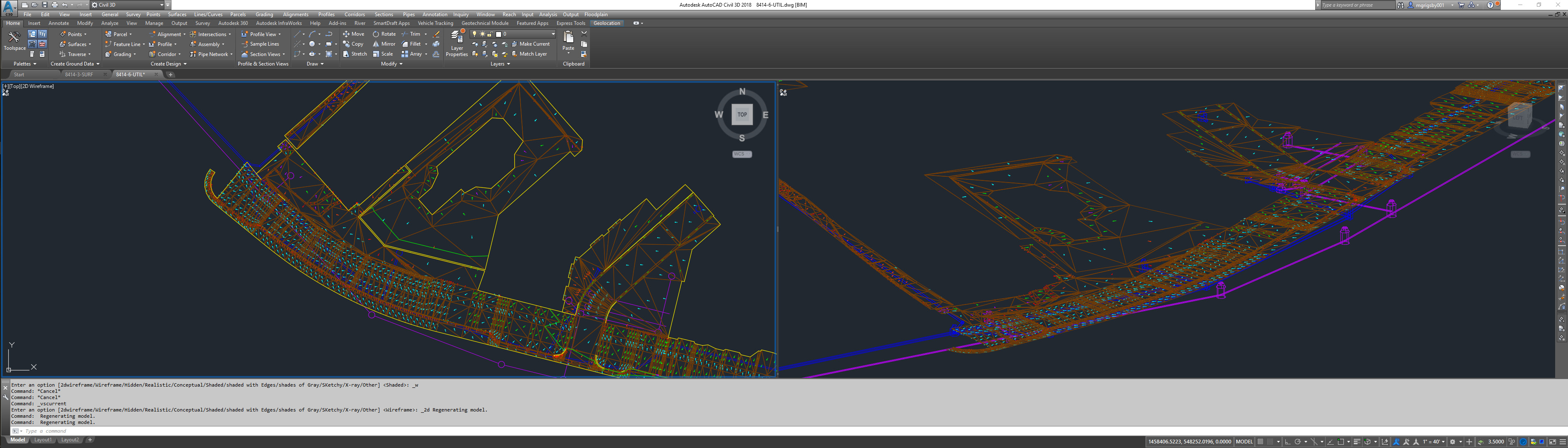
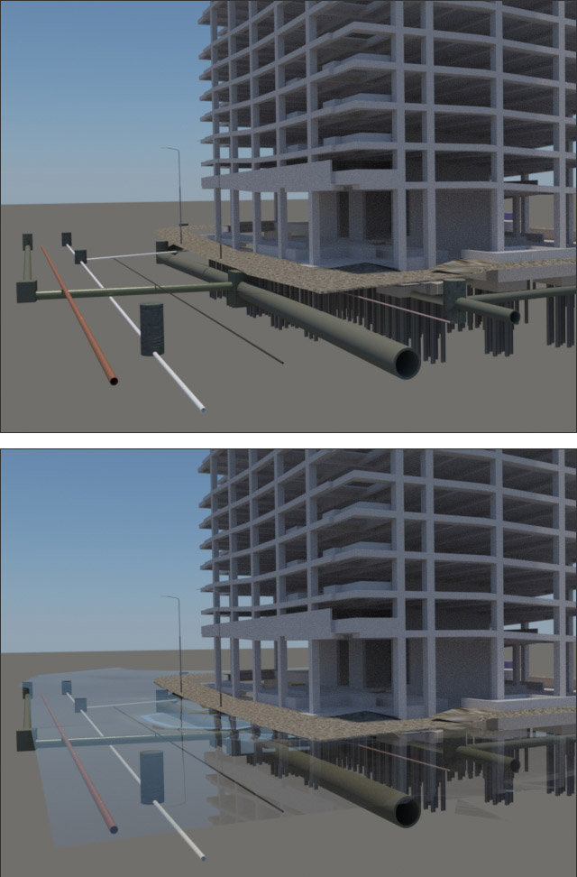
In terms of the tech we use most often, for a long time we were using AutoCAD to create 2D production drawings. Our focus more recently emphasizes creating projects in Civil 3D and Revit, allowing us to bridge the gap between our work and the work of the architects we’re collaborating with on projects (Figures 2 and 3).
We take a holistic approach to considering new technology: the new tool must support our process in three key ways:
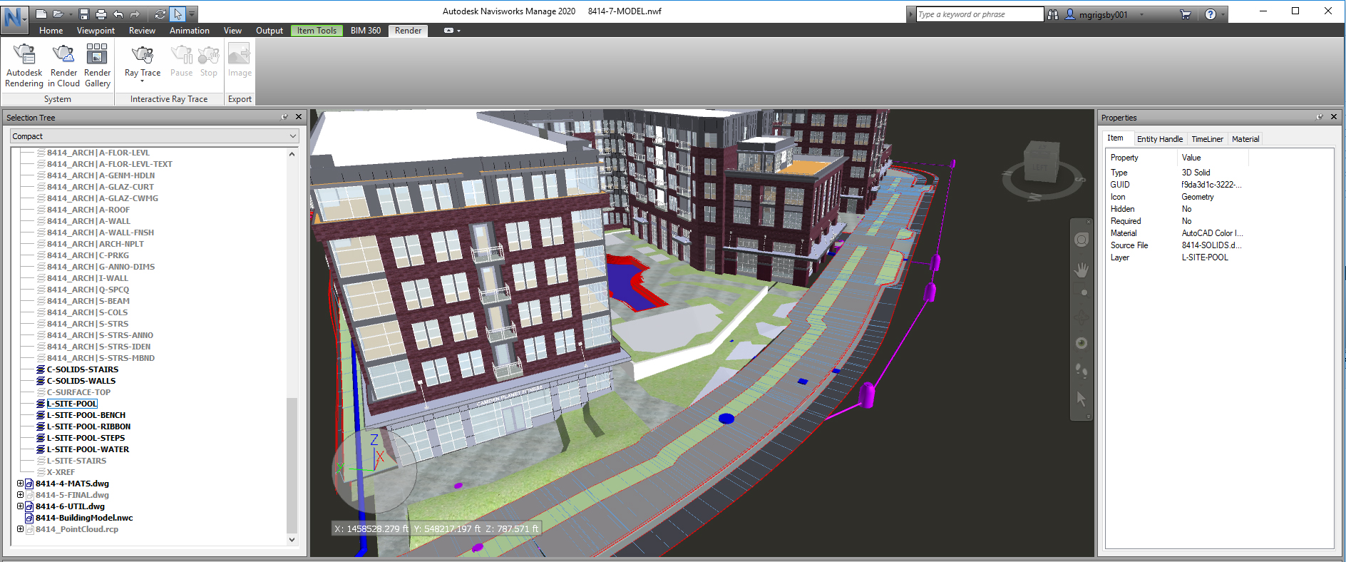
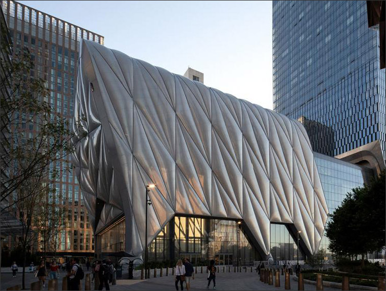
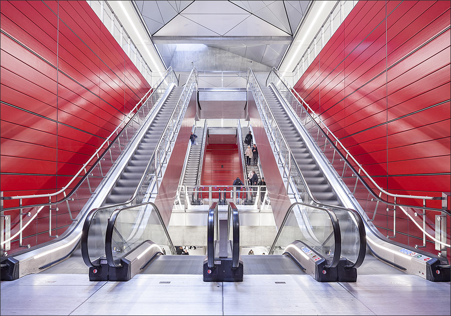
- First, the software or product must support our goal of creating better projects. We evaluate this with internal quality assurance/quality control procedures. For example, we now use a lot of 3D design tools because our quality control has demonstrated that it helps us make better design decisions (Figure 4).
- Second, it must improve our efficiency. It’s pretty easy to tell when a new technology is merely adding an unnecessary step. If we find we are doing the same work on multiple platforms, we know it’s time to reassess.
- Third, it must add value for our client. It’s important for our clients to know that we are at the leading edge of design and technology, but it’s more important that the technology can help the client to visualize their completed project. That way there are fewer surprises and late-in-the-process change orders. If a digital tool helps us get feedback early, that’s incredibly valuable.
Our process right now is strong, and the technology we’re using has met our three criteria listed above. But we continue to look for technology that will support a more streamlined and holistic approach. We are creating 3D models early on in our process, but we don’t have the kind of efficiencies available to architects. Many programs are created specifically for architects with their process in mind, making it easier for them to use the 3D model to output either construction documents or AR/VR-ready visualization tools as needed. We’re able to output the visualization tools, but so far, we are still trying to find the right program that allows us to be production-capable for construction documents. Many times, we’re forced to recreate the model after we’ve already gone through the documentation process.
So, one goal is to move into 3D earlier in our process. Autodesk Civil 3D software for civil engineers is useful for when we are modeling infrastructure as well as surfaces to show topography. But we would like a similar (and compatible) program that our landscape architects could use and combine with architects’ tools. Realistically, we know that it is going to take some time to make this process as efficient for landscape architects, but we know that we need to head in that direction, and we are dedicating time and energy to make sure we are at the forefront of the change. For now, we are able to work through creating surfaces in Civil3D to show grade relationships, as well as testing the efficiency of Revit as our modeling program rather than SketchUp.
Ironically, another big challenge is how quickly things change. To adopt new technology, we first go through a testing phase and an implementation phase, and we may not even know until the end of implementation whether the technology meets our three requirements. (Remember LandDesign’s mantra: Quality, efficiency, value to client.) If the timeline for both of these extends even to nine months, there may already be a newer, more advanced and equally promising software or product available by then!
At LandDesign, we’re investing in a dedicated group to manage and test technology. Currently there are five in the group: two landscape architects, a civil engineer, an IT leader, and a graphic designer with digital technology expertise. The diversity of backgrounds is very helpful for pushing the boundaries and rigorous testing. Still, with new tech arriving constantly, it’s hard to keep up.
We see the field evolving primarily in the direction of more and better user-friendly engagement platforms, which is great, though it can’t come fast enough. We’re also tracking a major evolution of geographic information systems (GIS) that we’re very excited about, largely because it is becoming something that can be easily integrated directly into Civil 3D.
GIS has always been a powerful tool for data collection, and it’s helpful with regional-level planning approaches. Now we’re seeing more and more levels and layers embedded, just waiting to be used. In one instance, we were able to take building data from a detailed and multi-layered GIS map of Charlotte and feed it into Civil 3D to reproduce a rough version of our city as a VR environment. This is a highly significant development, with potential to radically transform how we collaborate with clients, community leaders and other project stakeholders. The more data we can access, the greater our ability to create immersive, highly detailed visual environments and to employ 3D renderings, animations and VR as engagement tools early in the process.
Time is the new standard – it’s the most valuable thing technology can provide us. We strive to reduce the time required to process new documents or 3D-rendered environments. Likewise, we want to start getting critical feedback from our clients and bring them into the decision-making process as early as possible. So we are looking for tools that can streamline our complete process, and which are approachable and user-friendly.
While we are making wishes, we really want a landscape architecture-based software, something with a diversity of elements — especially plantings! Lumion is the best so far: It’s visually beautiful and great for our clients. But it’s not necessarily as smart as we’d like. The BIM aspect of it is purely a visualization and rendering tool and can’t be directly translated into construction documents, so it doesn’t lend itself to being part of a streamlined documentation process. The ideal landscape architecture software would let us focus on design, rather than managing documentation outputs and moving designs from platform to platform.
We’ve begun implementing drones in our process, which is exciting, and we even have a licensed pilot on our team. We’re still experimenting with how we can utilize drones on the front-end of the design process, such as acquiring quality topographical survey information. We are also utilizing them during construction administration to create flyovers that provide views of construction progress, and to capture footage to be used for communications.
Acknowledgments: The responses to the questions for this profile were provided by Eric Pohlmann, PLA, Principal, LandDesign, Charlotte, N.C. The profile was facilitated by Adam Sullivan of C.C. Sullivan.
Have comments or feedback on this article? Visit its AECbytes blog posting to share them with other readers or see what others have to say.
AECbytes content should not be reproduced on any other website, blog, print publication, or newsletter without permission.
This article explores the cutting-edge AEC technology applications developed by CORE Studio, a dedicated software development group at Thornton Tomasetti. The applications including Konstru, Swarm, Asterisk, Trace, and many more for design, analysis, collaboration and visualization.
Layer is a new AEC application that was launched close to six months ago to address what seems to be an obvious need in the industry—organizing and integrating the vast amount of disparate data that is typically collected on site during the retrofit or construction of a building project.
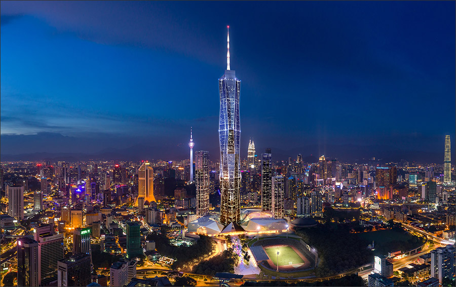
Fender Katsalidis describes the implementation of AEC technology on the “Merdeka 118” project, a 118-storey, mega-tall skyscraper under construction in Kuala Lumpur, Malaysia. Upon completion, it will become the tallest building in Malaysia and Southeast Asia, and the second-tallest building in the world.
This article describes the research that was conducted by a team at the Technical University of Denmark to study the impact of COVID-19 on the passenger flow in the Copenhagen Metro, using passenger flow data and station floorplan drawings as well as Bentley Legion software for simulation of pedestrian flow.